+998 71 273 65 93

Project “Mining allotment”

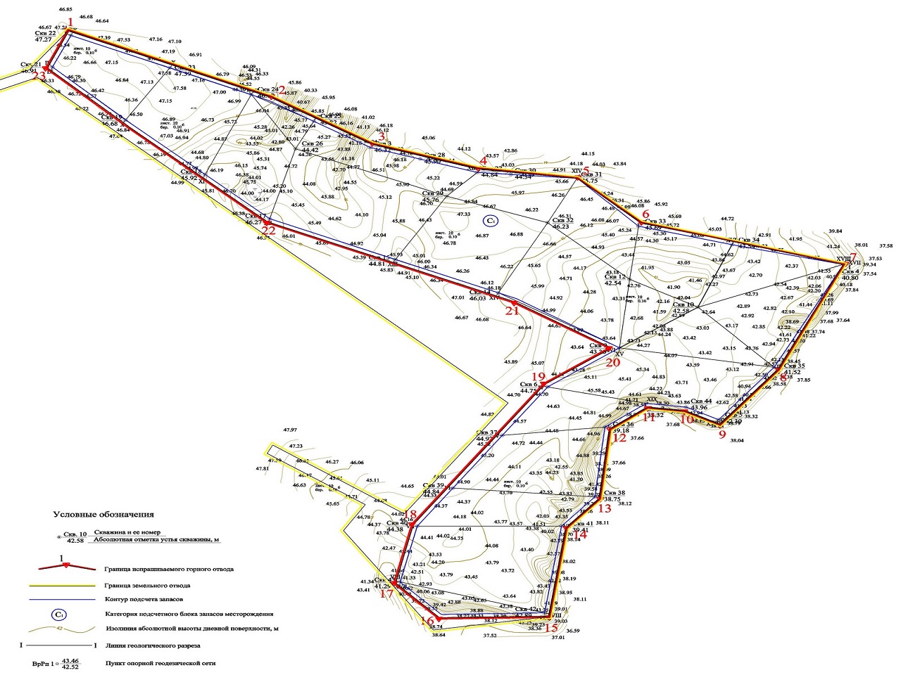
Collection, synthesis and analysis of data characterizing the spatial boundaries of the subsoil plot provided for use, its geographical and administrative location, natural and climatic conditions, geological and hydrogeological characteristics, mining-geological and hydrogeological conditions of development, development, design conclusions on assessing the impact of mining operations on the environment, general information about adjacent mining allotments.
Study of data on the quantity, quality, categorization and material composition of explored, approved and promptly recorded reserves of the main and co-occurring mineral resources.
Analysis of the state of project documentation for field development, conditions and state of field development;
Analysis of measures to protect subsoil and the environment during field development;
Analysis of the recommendations of the state examination of mineral reserves, compliance with the conditions of the license for the use of subsoil in terms of the boundaries of the mining allotment.
Justification of the boundaries of a mining allotment, including issues of rational and integrated use of mineral resources, protection of subsoil and the environment.